
Table of Contents
30th Jan, 2021 by: Himalayan Magic Treks
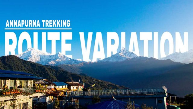
Annapurna Trekking Routes Variation Explained
Annapurna trekking routes
If you have ever been to trekking in Nepal, then you must have come to know about the Annapurna trekking. Trek like Annapurna Base Camp, Annapurna Circuit, Ghorepani Poon hill are some globally famous trekking which is done in Annapurna region. The routes are so diverse and huge that one can be simply confused. So this blog will explain all the Annapurna trekking routes that exists.
To know about the every route variation of the Annapurna trekking, I think it is necessary to know about the geography of the Annapurna region first.

Annapurna Conservation Area is the first and largest protected area of Nepal. It covers an area of 7629 km2. When someone mentions the Annapurna region, they are mostly referring to the Annapurna Conservation Area. All the world famous trekking of Annapurna is performed inside the Annapurna Conservation Area. You will need a government permit (known as ACAP permit) to enter the territory. The outer most border in the above map represents the ACAP. It is an absolute paradise of nature.
Annapurna Massif is a stunning mountain range in Annapurna Conservation Area with several high and stunning mountains including Annapurna I. It is 55 kilometers long and encloses with a high basin in west called the Annapurna Sanctuary.
Annapurna Sanctuary is a glacial basin enclosed by the ring of mountains of the Annapurna massif. It is oval in shape. The only entrance to the Annapurna Sanctuary is a narrow valley between the peaks of Hiunchuli and Machhapuchhre. Even at the peak of summer, the sanctuary only receives about 7 hours of sunlight in a day as it is confined by high mountains from all the sides. The Annapurna base camp also lies in the Annapurna Sanctuary. So the Annapurna base camp trek is also called Annapurna Sanctuary trek.
Annapurna Trekking Route Variations
You can click on the list below to skip to certain trekking.
- Ghorepani Poon hill trek
- Annapurna Base Camp / Sanctuary trek
- Annapurna Circuit trek
- Mardi Himal Trek
Pokhara is usually the main base point for most of the trekking in Annapurna region. It is also famous for its many tourist attractions. So it is considered the tourism capital of Nepal. Now, lets start with the shortest trek in Annapurna, Ghorepani poon hill.
Please note that the maps is provided for the reference to the Annapurna region so is it is not in scale.
Ghorepani Poon Hill Trek

Introduction:
As mentioned above, this trekking is the shortest trekking destination in Annapurna region but it is also the path to many trekking in Annapurna region like the Base Camp trek, Annapurna circuit and many more. Poon hill is a hill station in Ghorepani village from where you can see the stunning sights of Annapurna Massif and Dhaulagiri Massif range. The viewpoint is about 1 km far from Ghorepani. Poonhill is usually visited in the morning because of the marvelous sunrise that you can witness from the poon-hill.
Routes:
The two major destination or stop of this trek is the PoonHill which is a hill station and the beautiful villages of Gurungs, Ghorepani. The journey begins after we reach Nayapul in vehicle. We head towards several places like Birethanti, Tikhedunga and to the Poon hill. The trek to only Poon Hill is possible but since it can be achieved in mere 3-4 days, a visit to Ghandruk village is very advantageous because foremost it will avoid the returning back on the same trail from the Poon hill up to Nayapul and it can lengthen the itinerary for a perfect week trip. We pass Tadapani on the way to the Ghandruk. The whole Ghorepani-Poon trek is about 67.5 kilometers long.
Mountains you can observe during the Ghorepani Poon Hill Trek:
- Dhaulagiri (8,167 m)
- Annapurna I (8,091 m)
- Annapurna II (7,937 m)
- Annapurna III (7,555 m)
- Gangapurna (7,455 m)
- Annapurna South (7,219 m)
- Gurja Himal (7,193 m)
- Nilgiri Himal (7,061 m)
- Machapuchare (6,993 m)
- Tukuche peak (6,920 m)
- Hiunchuli (6,441 m)
- Dhampus peak (6,012 m)
Book Ghorepani Poon Hill Trek
Annapurna Base Camp Trek
Introduction:
Annapurna Base Camp trek, also known as Annapurna Sanctuary trek lies beneath the mighty mountains of Annapurna I and Annapurna South. It is very close to the MBC (Machhapuchhre Base Camp). Annapurna Base Camp is also an essential point for several expeditions in Annapurna.
Routes:
There are some different ways to reach Annapurna Base Camp. The first one is the popular one where we continue from the above Ghorepani trekking. But normally, we do not stay in the Ghandruk on the way to the base camp instead we rest at rest at Tadapani. But if you want you can stay in the Ghandruk village on the way back where we will walk from Chhomrong down to Komrong and Ghandruk.
You should know that the Chhomrong is the absolute point for the ABC trail which means there are various ways to reach the Chhomrong but ahead of it, there are no any diverse route to reach ABC. Below are the major stops for the overnight on the way to Annapurna Base Camp (ABC).
Nayapul →Tadapani →Kimrung →Jhinu Danda →Chhomrong →Sinuwa → Bamboo →Dovan→ Deurali →MBC →ABC.
The ABC trek is very flexible because of these various stops.
There is another route where we begin from Nayapul moving to Jhinu Danda through New Bridge to Chhomrong and all the way to ABC. But I think this program is very exhausting. There is also another less travelled route where we start from Kande to Pothana and Landruk to Chhomrong and to the base camp. This route is also the path to the Mardi Himal trekking. The turning point for the two trekking is the Bhichok (Pitam) Pass where the right turn leads to the Mardi himal base camp where as the left leads to the Landruk village.
Mountains you can observe during the Annapurna Base Camp Trek:
- Dhaulagiri (8,167 m)
- Annapurna I (8,091 m)
- Annapurna II (7,937 m)
- Annapurna III (7,555 m)
- Gangapurna (7,455 m)
- Annapurna South (7,219 m)
- Gurja Himal (7,193 m)
- Nilgiri Himal (7,061 m)
- Machapuchare (6,993 m)
- Tukuche peak (6,920 m)
- Hiunchuli (6,441 m)
- Dhampus peak (6,012 m)
Book Annapurna Base Camp Trek
Annapurna Circuit Trek

Introduction:
As the name point out, this route circles around the Annapurna massif. The highest point of this trekking is Thorong la pass which stands at 5461 meters height. This trekking is about three weeks. This trekking route is often considered the best long distance trek in the world due to the fact that the route has wide variety of climate zones and various cultural differences from Hindu to Tibetan
Routes:
The trekking can be done both clockwise and anti-clockwise but the anti-clockwise is more popular. The anti-clockwise is favored and better because of various reasons. First, It is very hard to do clockwise. You will have to face huge altitude gain (1700 m+) during the Thorongla Pass with no better accommodation facilities. You might have to deal with the acclimatization issues. To make it worse, you will be exhausted from the long two weeks of journey before you go through Thorong La pass. You will also be moving in the opposite direction so less travelers on the same way meaning less interaction and less help in trouble. Watching you people might think “oh! they might have forgotten something”. [It is a joke please]
The journey starts from Besisahar where the trekking permit is also checked. The way goes from Dharpani to Chame to Pisang. It is also possible to drive from Besisahar to Chame but the roads are very narrow and a bit scary. So, it is slow. I mean everyone fears their life so will the drivers. Taking the drive also means you will be missing a part of the journey and the beautiful scene around Bahundanda and Ghermu.
Following the Marsyangdi river valley we move all the way to Manang. In Manang, you will have to let your body rest for acclimatization, preparing for the next arduous Thorong la pass. You will have no convenient accommodation like in Manang for acclimatization for the Thorong la pass if you trek clockwise. There is another side trek you can do after reaching Manang which is called Annapurna Circuit Trek with Tilicho Lake. It might be better to take a drive between Besisahar and Chame in this trekking variation to reduce the itinerary. This route variation goes from Khangsar to Tilicho Base Camp. We visit the Tilicho lake the next morning and return back to the base camp. Then we trek from Yak kharka and head towards Thorong la pass. After the pass, we move from Muktinath to Kagbeni to Jomsom to Lete and to Tatopani. Tatopani is a natural host to many hot springs. Toto-pani literally translates as hot-water. These Hot springs are believed to cure off many bone related diseases. The trail then continues from Ghorepani to Nayapul and to Kathmandu.
Mountains you can observe during the Annapurna Circuit trail:
- Annapurna I Central (8,041 m)
- Annapurna II (7,937 m)
- Annapurna III (7,555 m)
- Annapurna IV (7,525 m)
- Gangapurna (7,455 m)
- Annapurna South (7,219 m)
- Annapurna Fang (7,647 m)
- Khangsar Kang (7,485 m)
- Tarke Kang (7,202 m)
- Lachenal Peak (7,140 m)
- Tilicho Peak (7,135 m)
- Nilgiri Himal North (7,061 m)
- Nilgiri Himal Central (6,940 m)
- Nilgiri Himal South (6,839 m)
- Machhapuchchhre/ Fish Tail Mountain (6,993 m)
- Hiunchuli (6,441 m)
- Gandharba Chuli (6,248 m)
Book Annapurna Circuit Trek
Mardi Himal Trek
 Introduction:
Mardi Himal Trek is the less crowded trekking destination in Annapurna Conservation Area. Mardi Himal route became popular after first ascent was made in 1961, Mardi Himal route offer unspoiled natural beauty a hidden jewel among all the glorious Himalayan country of Nepal. This trekking is short and easy to perform. Mardi Himal base camp is the main objective of this trek. The camp lies at the height of 4500 meters.
Routes:
The route of the Mardi Himal Trek is somehow straight and simple. The journey usually begins after a drive to Kande. Then we go through places like Australian camp, Pothana, Forest camp, Mardi himal low camp, high camp and finally to the Mardi Himal Base Camp. There are two routes you go back from: Sidhing and Landruk. After reaching low camp on the return we will meet two cross routes where one leads to Sidhing and other to Forest camp. The forest camp also has cross roads where one is the same that we came from and the other route leads to Landruk. From Sidhing you can take drive to Pokhara whereas from Landruk you can roam around traditional villages of Annapurna and do many side treks.
Mountains you can observe during the Annapurna Circuit trail:
- Dhaulagiri (8,167 m)
- Annapurna I (8,091 m)
- Annapurna II (7,937 m)
- Annapurna Fang (7,647 m)
- Annapurna III (7,555 m)
- Annapurna IV (7,525 m)
- Gangapurna (7,455 m)
- Annapurna South (7,219 m)
- Machhapuchchhre/ Fish Tail Mountain (6,993 m)
- Hiunchuli (6,441 m)
- Gandharba Chuli (6,248 m)
- Mardi Himal (5,553 m)